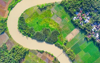
Orthomosaic photos find use in a wide range of industries and applications, including:
- Construction: Contractors can leverage these images to monitor construction progress, detect defects, and enhance safety on construction sites, facilitating timely and cost-effective completion of their projects.
- Agriculture: Farmers can use orthomosaic photos to monitor crop health, detect plant diseases, and improve crop yields, thereby enhancing their agricultural productivity.
- Environmental monitoring: Conservationists can utilise orthomosaic photos to monitor the health of ecosystems, track wildlife, and identify environmental threats, thus aiding in effective environmental management.
- Infrastructure planning: Engineers and planners can employ these images to design and analyse infrastructure projects, including roads, bridges, and buildings, enabling the creation of sustainable and efficient infrastructure.
- Real estate: Real estate agents can use orthomosaic photos to showcase properties and provide prospective buyers with an aerial view of the location, enhancing the marketing potential of their properties.
One of the advantages of orthomosaic photos is that they can be turned around quickly. This quick turnaround, combined with their high resolution and accuracy, makes them an ideal tool for emergency response and disaster management, where quick and informed decision-making is critical.
Overall, orthomosaic photos are an invaluable and versatile tool for anyone who requires detailed and accurate images of an area. Whether you are a farmer, a contractor, a conservationist, an engineer, or a real estate agent, these photos can provide valuable insights and aid in informed decision-making. With the growing availability and affordability of drone technology, orthomosaic photos are becoming increasingly accessible, enabling a broader range of people and industries to benefit from their myriad applications.
With years of experience in the industry, we are committed to delivering high-quality and innovative solutions that meet your specific requirements. Contact Airtech Images today to discuss how we can help bring your project to life.
Written by Toby Hope
Managing Director of Airtech Images Ltd


